Skip to content Skip to footer

BBMP and Bengaluru Urban Landcover - 2021

Updated Date: 04 Feb 2024 

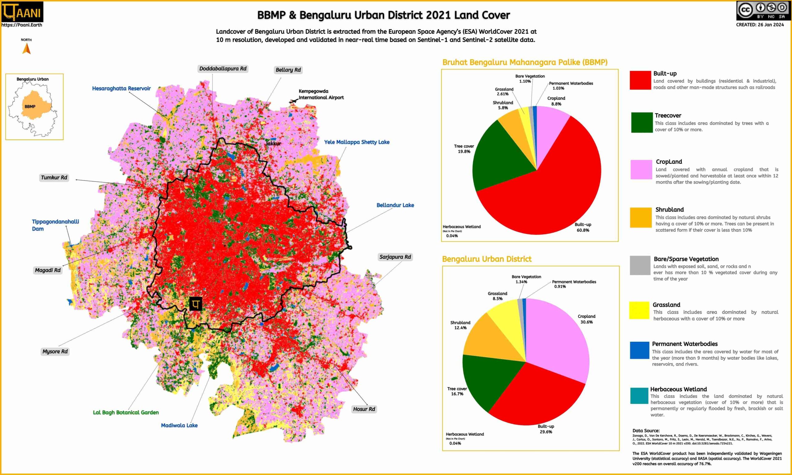
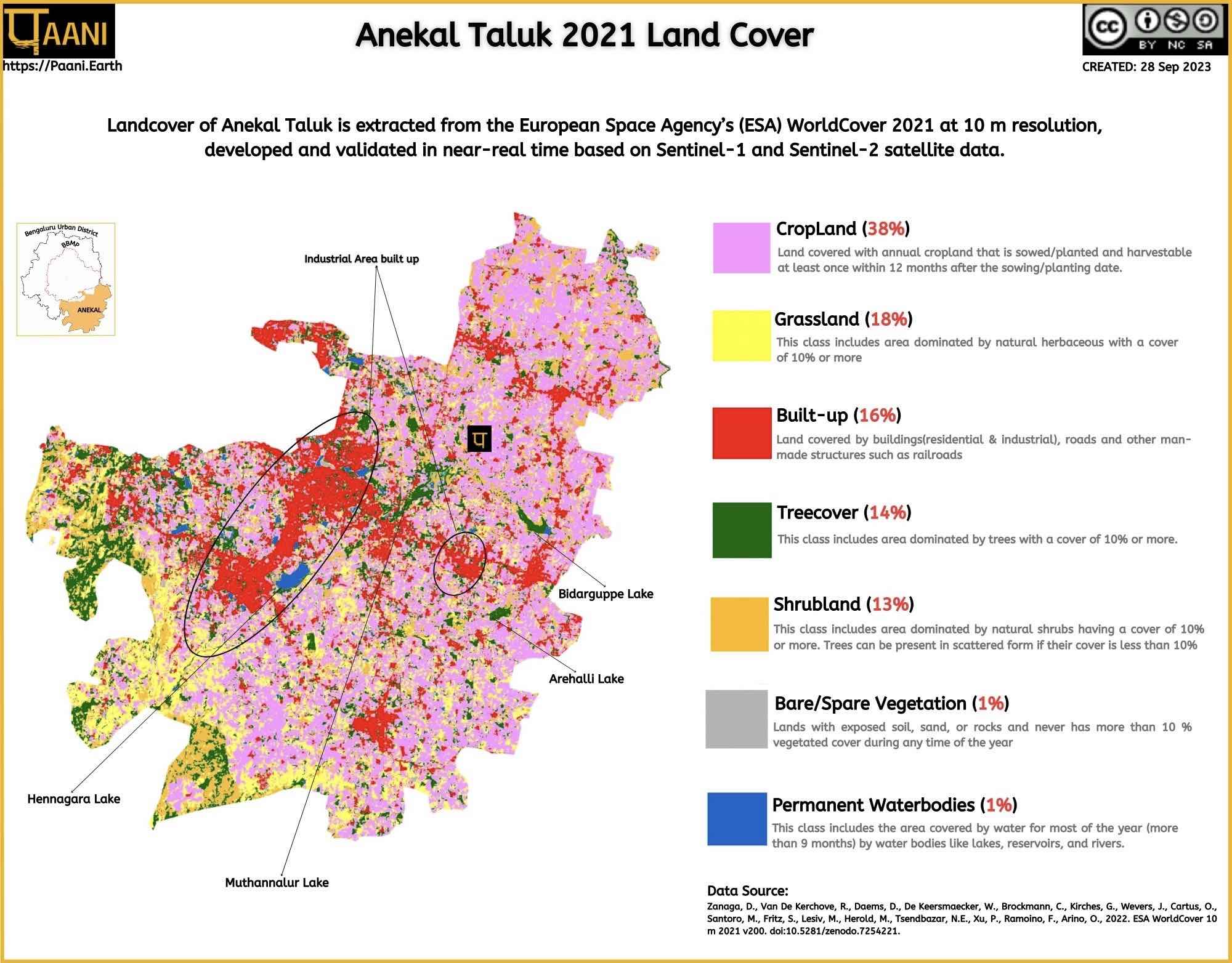
Bruhat Bengaluru Mahanagara Palike (BBMP) and Bengaluru Urban District Land cover is extracted from the European Space Agency (ESA) World Cover 2021 (based on v200 Algorithm). This freely accessible global land cover product at 10 m resolution for 2021 is based on both Sentinel-1 and Sentinel-2 data, containing 11 land cover classes and independently validated with a global overall accuracy of 76.7%.

The BBMP area shows 60.8% built up with only 1.03% permanent water bodies and 19.8% tree cover. 

Also, check out Anekal Taluk’s Land cover here

Other land cover can be found here.

Land Cover ESA 2021
RIVER BASIN
DAMS & FLOW
POLLUTION
GROUNDWATER
STRAWS
BIODIVERSITY
RAINFALL FLOODS & DROUGHT
RESTORATION
MINING
Creative Commons License
Paani.Earth by Paani.Earth is licensed under a Creative Commons Attribution-NonCommercial-ShareAlike 4.0 International License
Best Choice for Creatives
This Pop-up Is Included in the Theme
Purchase Now