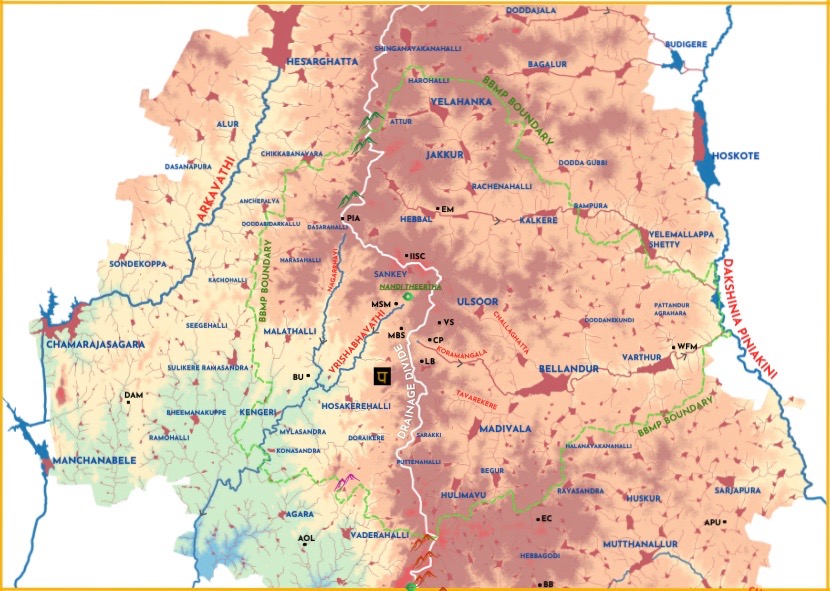
Rivers of Bengaluru
A crisp perspective on the use and abuse of rivers that is of concern to Bengaluru
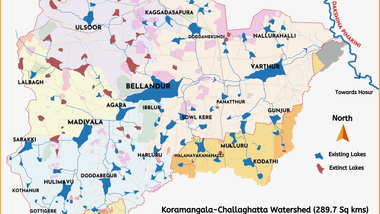
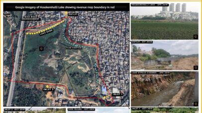
Waterbodies of Bellandur/Varthur Catchment (KC Valley)
A repository of maps, data and analysis on Koramangala Challaghatta Watershed
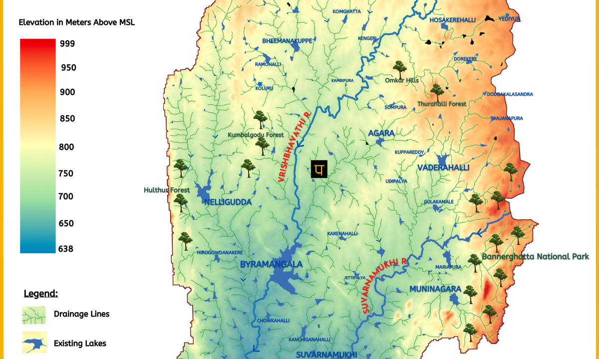
Waterbodies of Vrishabhavathi River Basin
A repository of maps, data and analysis
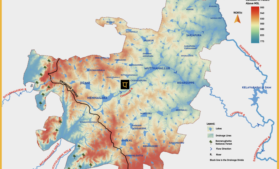
Waterbodies of Anekal Taluk
A repository of maps, data, and analysis on rivers & lakes of Anekal Taluk in Bengaluru Urban District
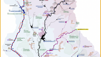
Arkavathi River Basin
A repository of maps, data and analysis on Arkavathi River Basin
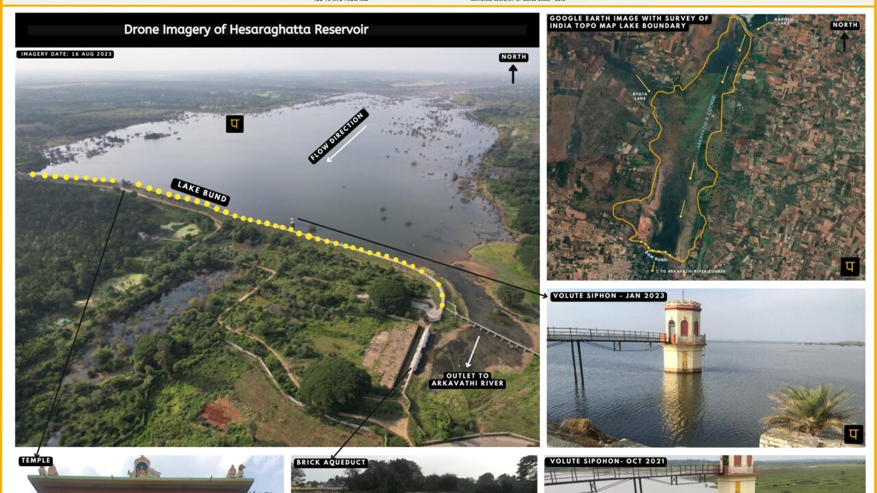
All about Hesaraghatta Lake Catchment
Data & analsysis of all things related to Hesarghatta reservoir & catchment
Report
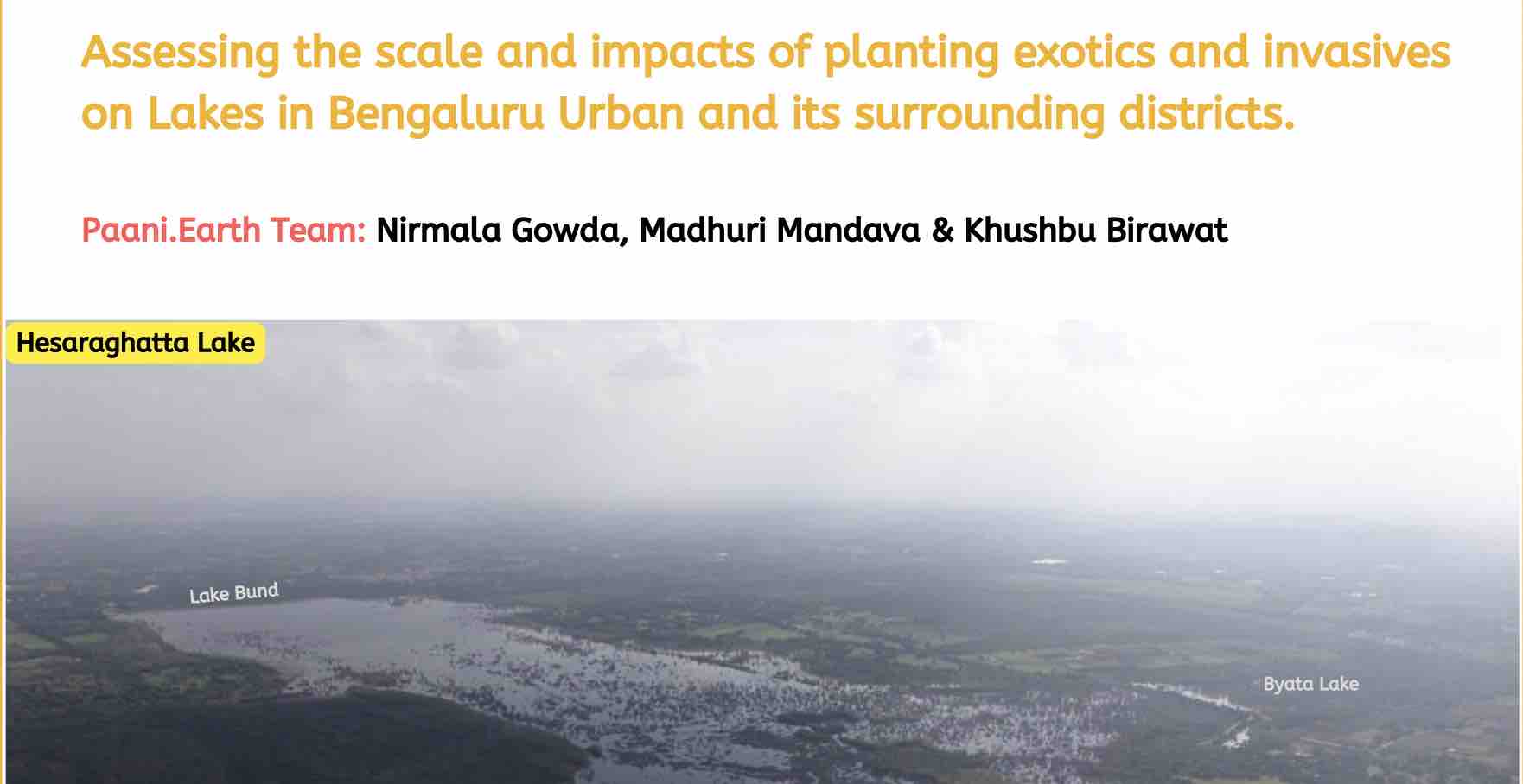
Assessing impacts of planting exotics and invasive trees on Lake of Bengaluru and its surroundings.
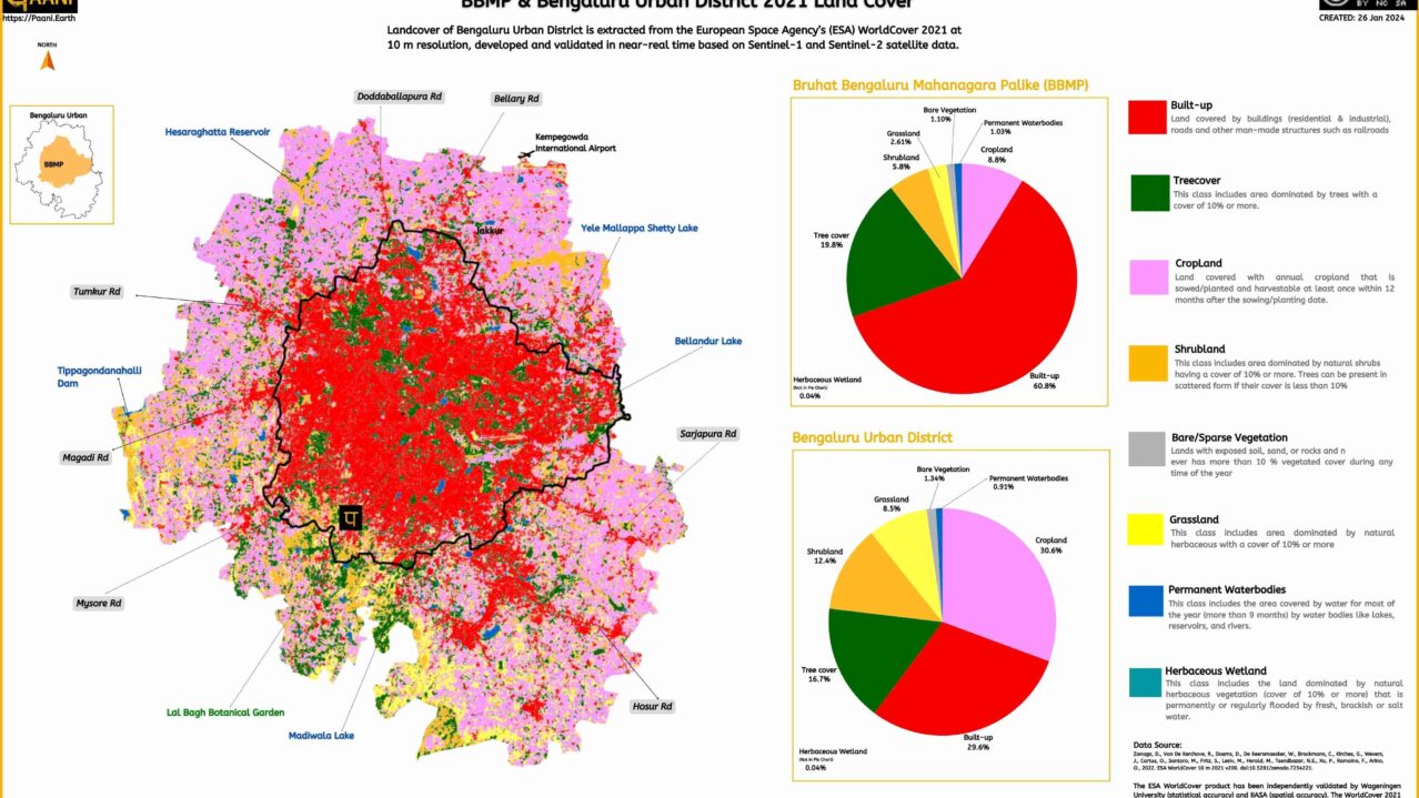
Bengaluru Landcover -2021
From European Space Agency’s (ESA) WorldCover 2021
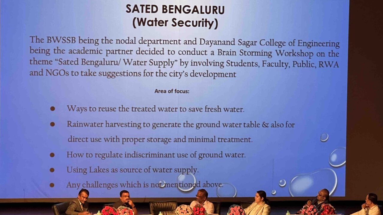
Brand Bengaluru
Paani suggestions to themes Sated Bengaluru and Green Bengaluru
