
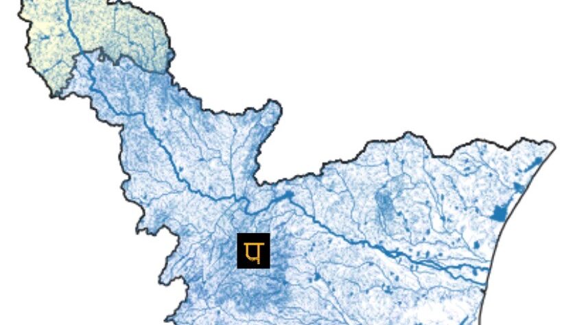
Elevation of KC Watershed
Data is from Shuttle Radar Topography Mission (SRTM) of United States Geological Survey(USGS)
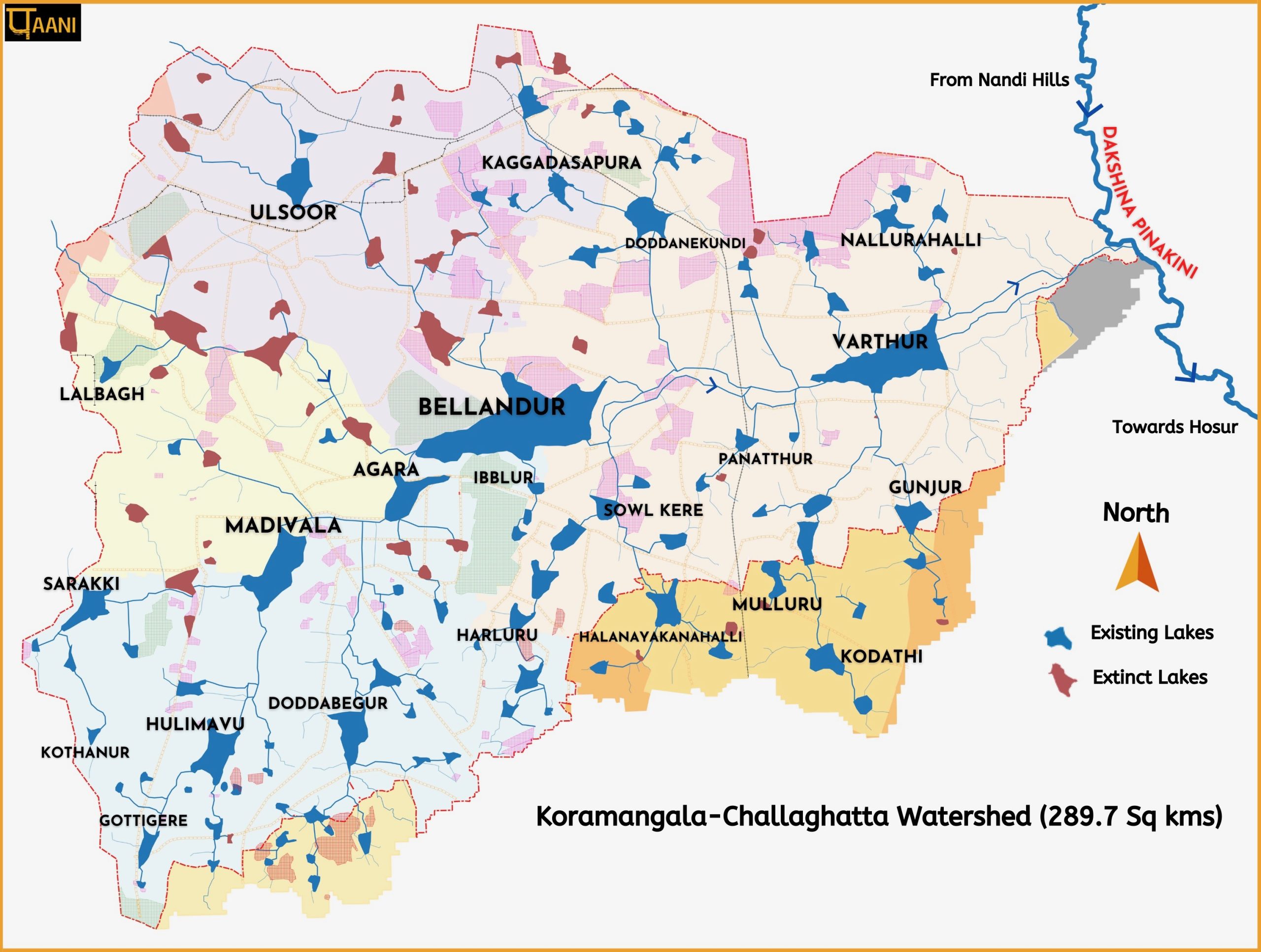
Dakshina Pinakini River Basin
KC watershed is part of Dakshina Pinakini River Basin. The page captures everything related to the river.
