Report
Uncovering the Hidden Pollution in the Arkavathi: Emerging Contaminants Impacting Bengaluru & Beyond
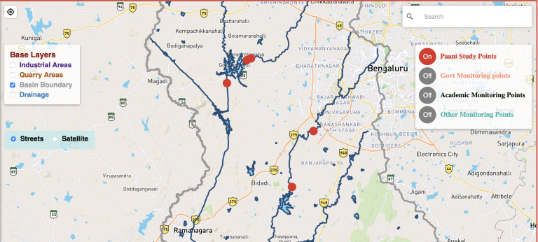
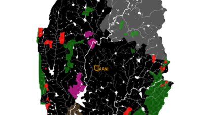
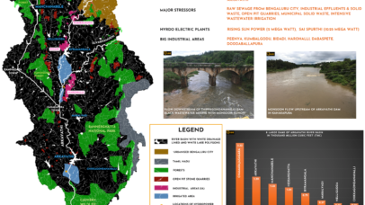
Arkavathi River Basin Pollution Map
An interactive map to understand the pollution in the river basin
Report
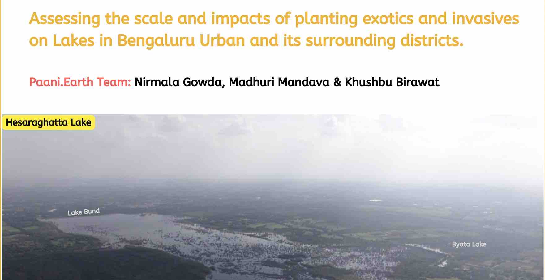
Assessing impacts of planting exotics and invasive trees on Lakebeds.
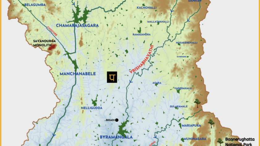
VRISHABHAVATHI RIVER
A comprehensive knowledge base of the Vrishabhavathi river, a significant tributary of Arkavathi
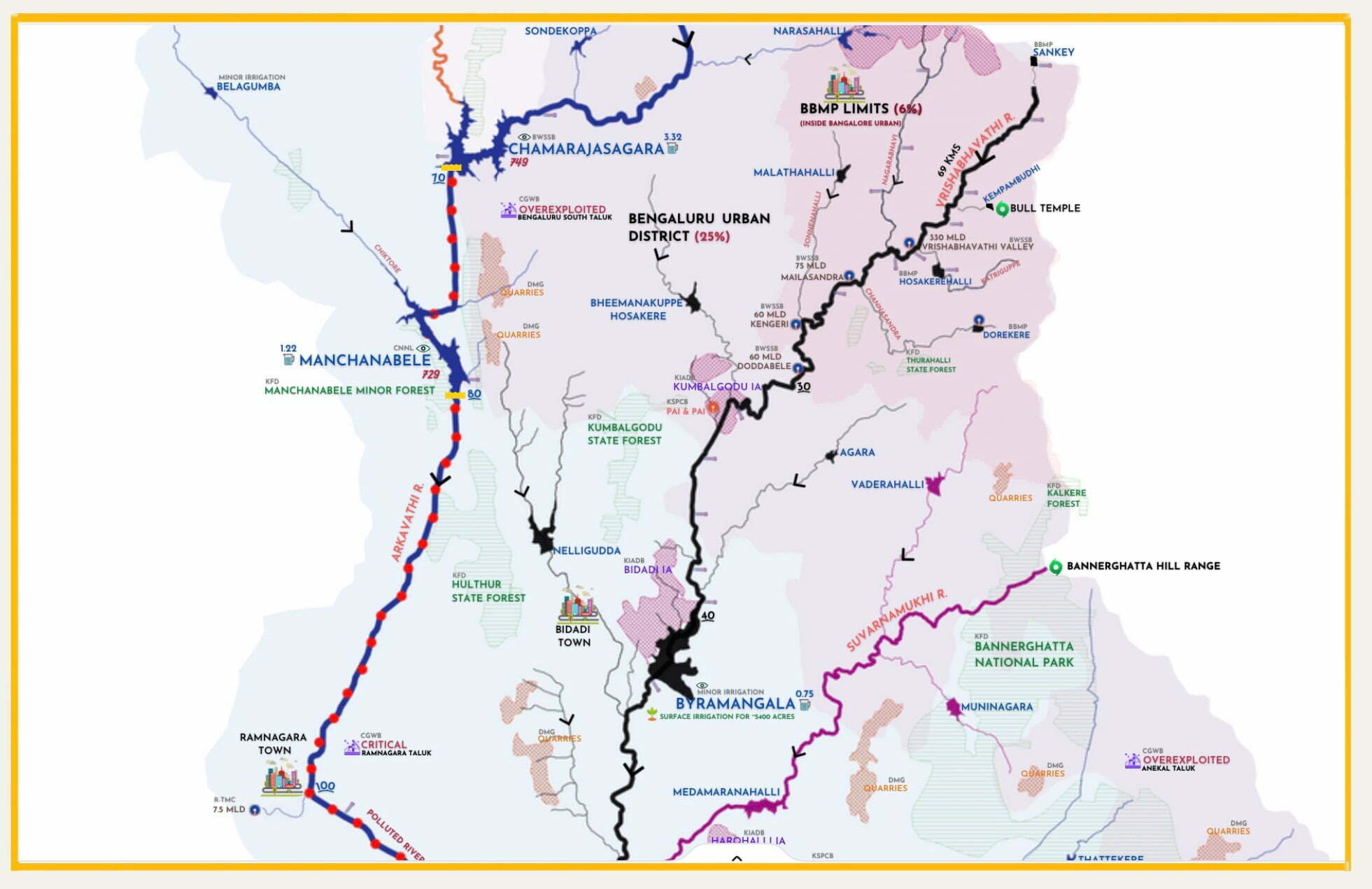
Arkavathi River Basin Hydrology
Self-explanatory infographic shows the surface hydrology overlaid on topography
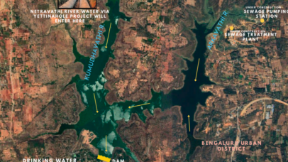
Thippagondanahalli Reservoir Profile
Provides data on Thippagondanahalli Reservoir
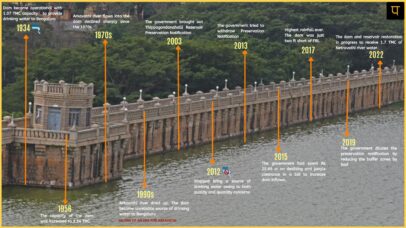
The rise and fall of Thippagondanahalli Dam
The reservoir's journey from being Bengaluru’s source of water to Bengaluru’s sink for waste
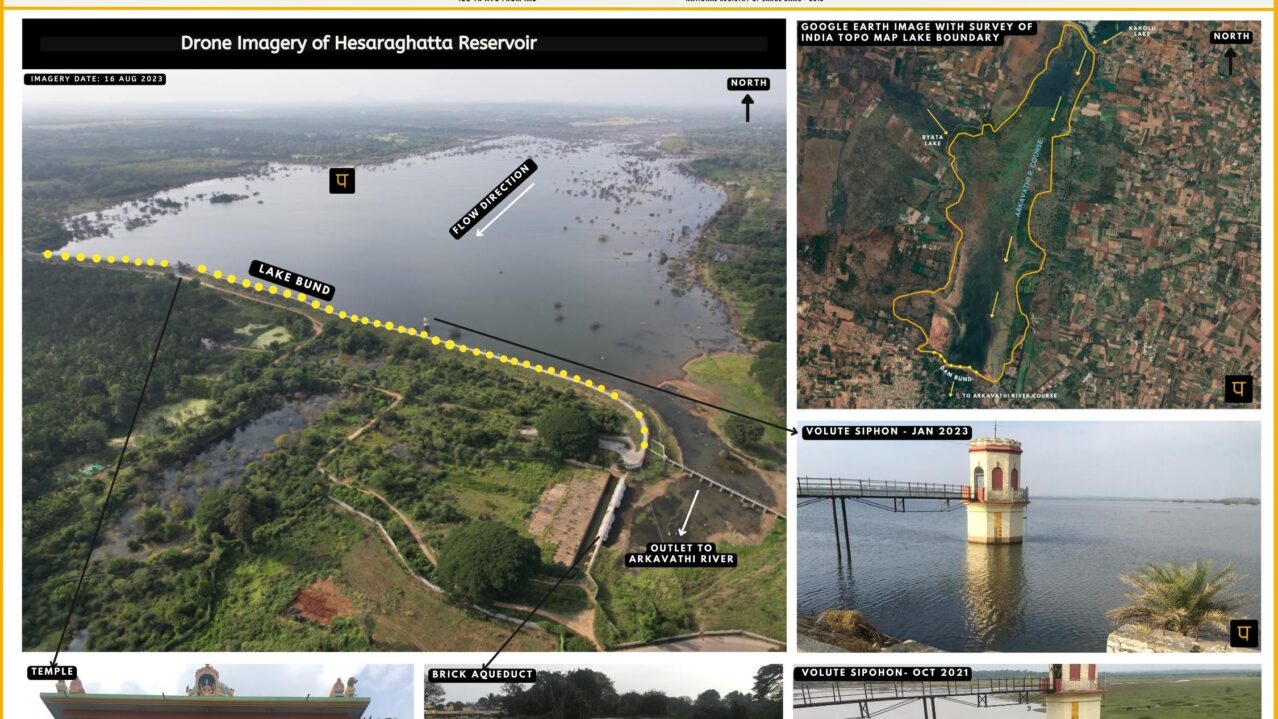
All about Hesaraghatta Lake Catchment
Data & analsysis of all things related to Hesarghatta reservoir & its catchment
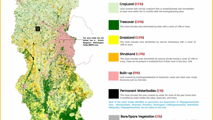
Arkavathi Basin Landcover
Extracted from European Space Agency’s (ESA) WorldCover 2021

RIVER BASIN

DAMS & FLOW

POLLUTION

GROUNDWATER

STRAWS

BIODIVERSITY

RAINFALL FLOODS & DROUGHT

RESTORATION

