Updated Date: 19 Aug 2023
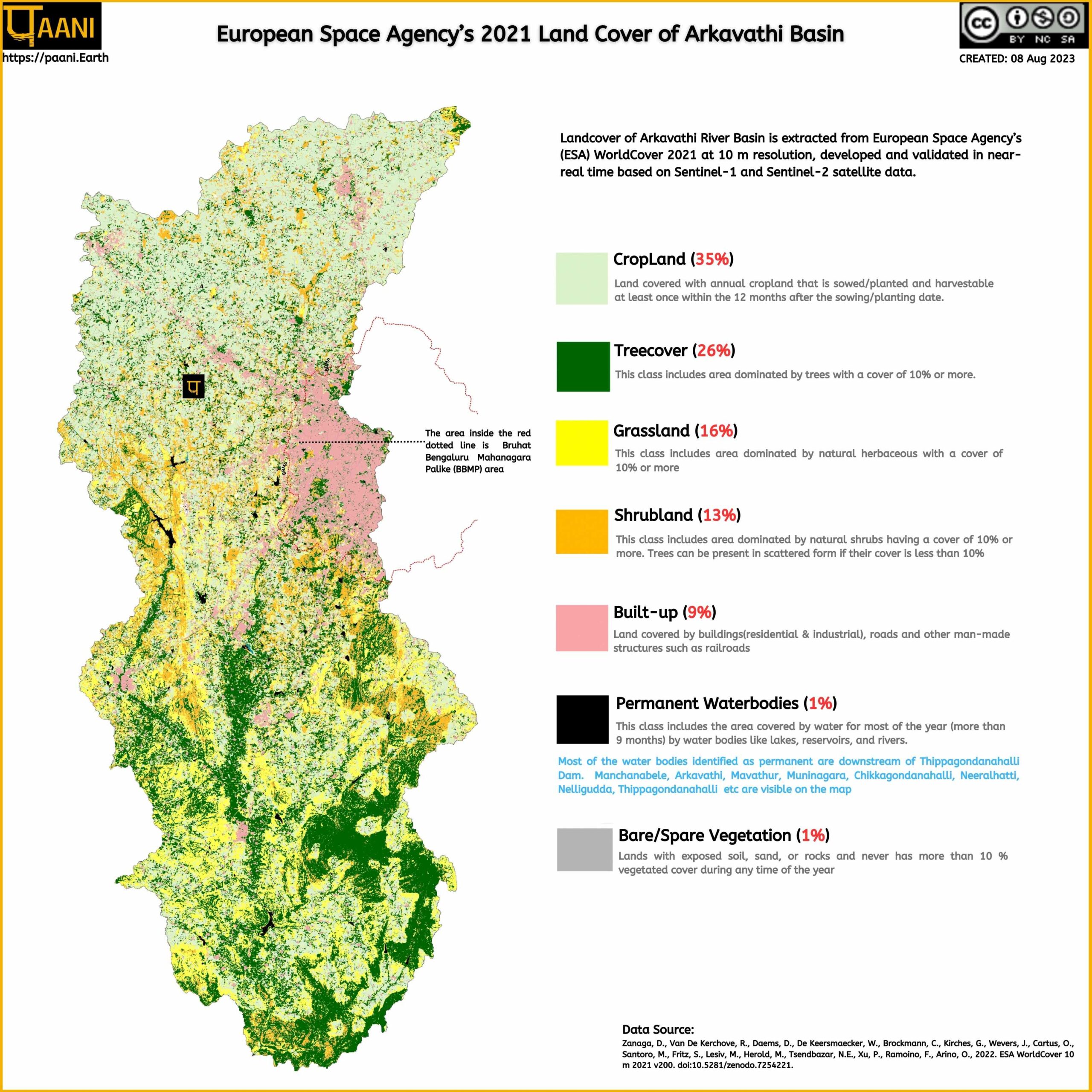
Landcover of Arkavathi River Basin is extracted from European Space Agency’s (ESA) WorldCover 2021, which is at 10-meter resolution, developed and validated in near-real time based on Sentinel-1 and Sentinel-2 satellite data.
The land cover map & data of the Arkavathi River basin allows us to examine the current land condition within the basin.
It is especially helpful for Karnataka State Pollution Control Board (KSPCB) for many key purposes, such as assessing non-point sources of pollution. KSPCB can also use this as a starting point with which various environmental monitoring activities (i.e water quality) can be performed. Most importantly, KSPCB could have used it in the planning and execution of the Arkavathi polluted river stretch (as ordered by National Green Tribunal in the case of OA No. 673 of 2018 dated 20.09.2018).
The citizens can also use this to validate the KSPCB’s river restoration plans and give feedback. Furthermore, this can be used for environmental impact analysis of projects by the state and society. In this case, the ‘state’ is the Ministry of Environment & Forest, whose responsibility it is to grant environmental clearances.
Credit: This article has been made possible by the generous contribution of time and skills by Srivalli Kiran.
The self-explanatory infographic below shows the 2021 land cover of the Arkavathi River basin.

RIVER BASIN

DAMS & FLOW

POLLUTION

GROUNDWATER

STRAWS

BIODIVERSITY

RAINFALL FLOODS & DROUGHT

RESTORATION

