Skip to content Skip to footer

Hesaraghatta Lake, built across the Arkavathi River, has a catchment of 602 sq km with more than 200 lakes. Commissioned in 1895 to provide drinking water to Bengaluru, Hesaraghatta Lake dried up 27 years later in 1922. It has since remained an unreliable water source for the city.

In recent decades, the degradation of the Hesaraghatta Lake catchment has intensified. Encroachment of lakebeds and drainage, obstructions to drainage like check dams, over-exploitation of groundwater, siltation, massive commercial plantations on lakebeds by the forest department, and disjointed rapid urbanisation are all the major factors contributing to hydrological degradation of the catchment.  

This page provides data and information about the catchment.

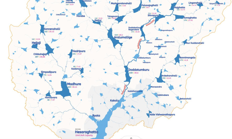
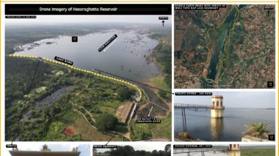
Hesaraghatta Lake Catchment Map

Coming Soon

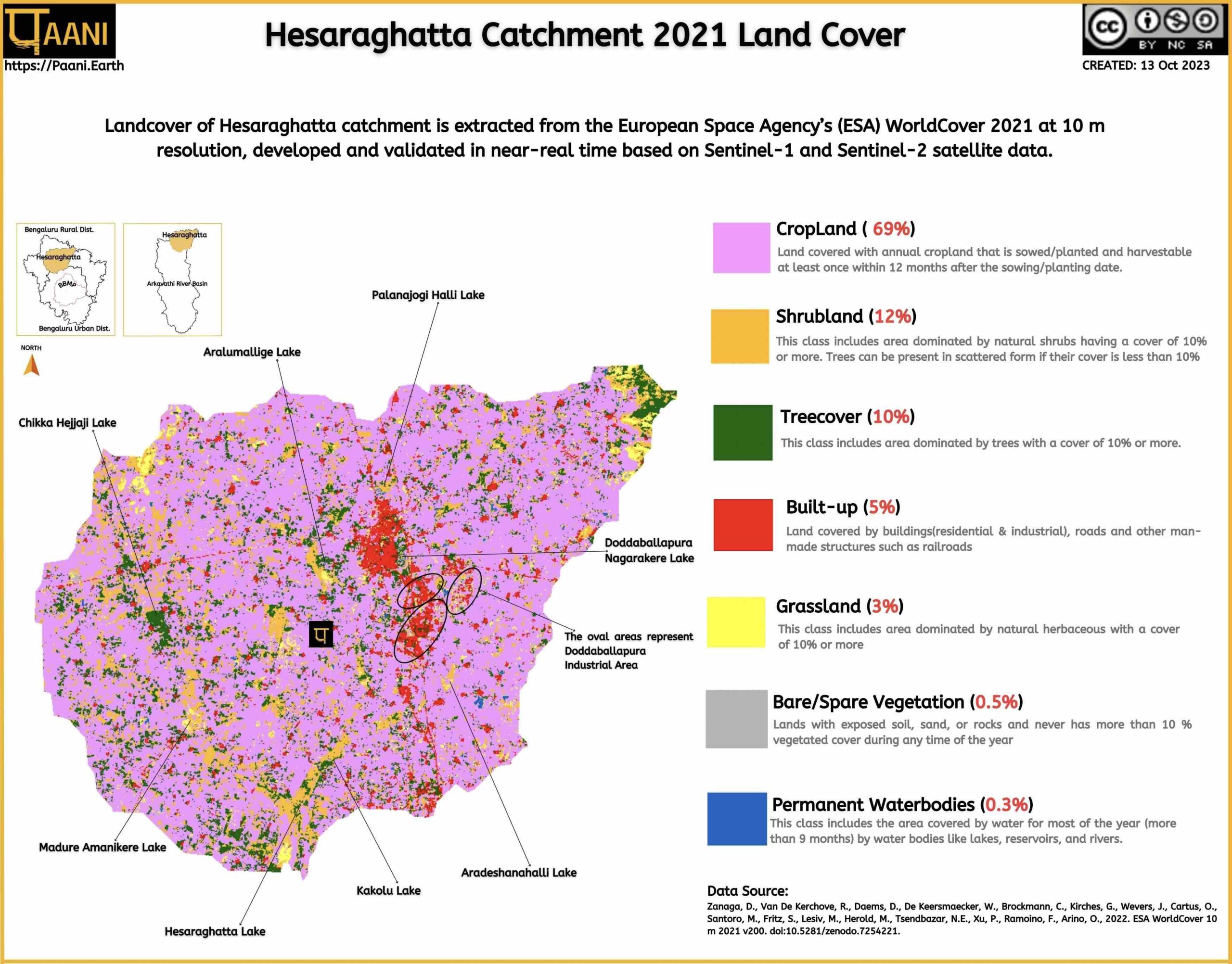
Hesaraghatta Lake Catchment Landcover

Extracted from European Space Agency’s (ESA) WorldCover 2021

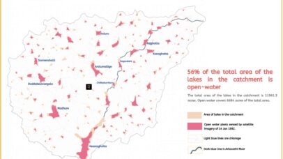
Fragmentation of Open Water

A remote sensing analysis of open water fragmentation
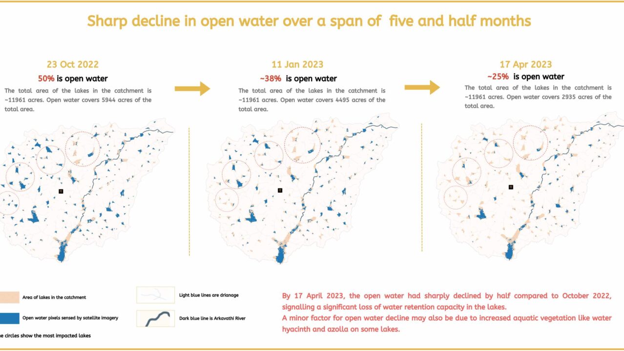
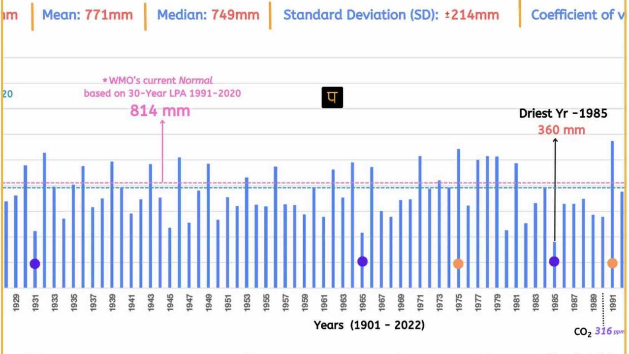
Open Water Decline

A remote sensing analysis of open water decline in the catchment .

Hesaraghatta Lake Profile

Information on Hesaraghatta Lake, Bengaluru Urban District
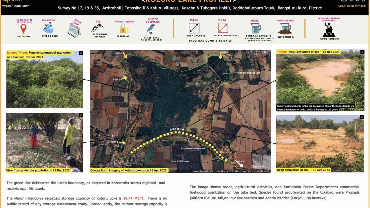
Koluru Lake Profile

Information on Koluru Lake, Bengaluru Rural District

Lake Governance Related

Compilation of lake governance-related reports and articles

Creative Commons License
Paani.Earth by Paani.Earth is licensed under a Creative Commons Attribution-NonCommercial-ShareAlike 4.0 International License
Best Choice for Creatives
This Pop-up Is Included in the Theme
Purchase Now