Skip to content Skip to footer

Hesarghatta reservoir constructed on Arkavathi river, is spread across 1224 acres. This platform provides the necessary data points for citizens  & policymakers to address Hesarghatta reservoir and its catchment concerns.


Shows Hesarghatta lake inlet, outlet, lake bund, siphon and brick aqueduct. Click the image on the left to load the profile.

The lake is in the Arkavathi River Basin. The river basin map shows Hesarghatta Lake. 

The lake is in the Bengaluru Urban District. The Bengaluru Urban Hydrology Map shows the lake.

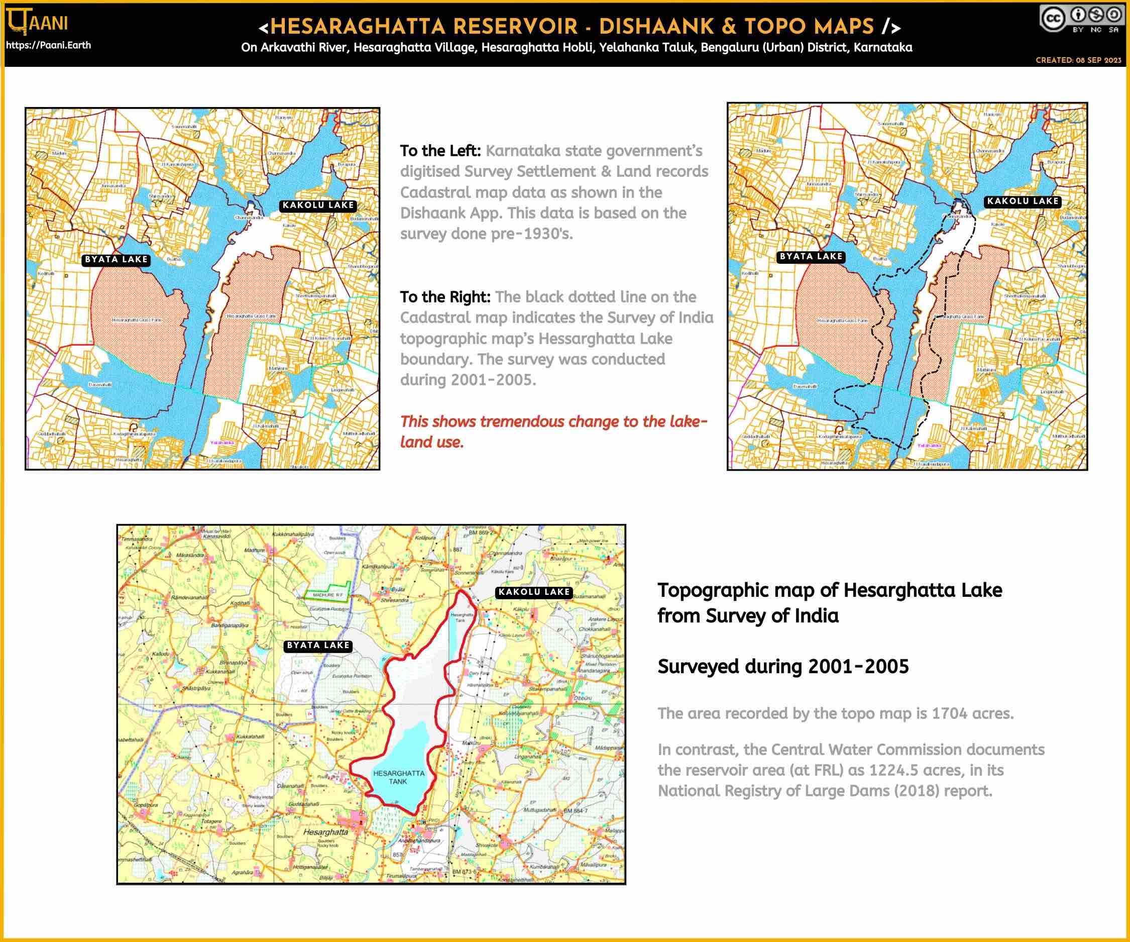
Dishaank & Topo Maps

Hesarghatta Reservoir as represented in Dishaank and Topo Maps .

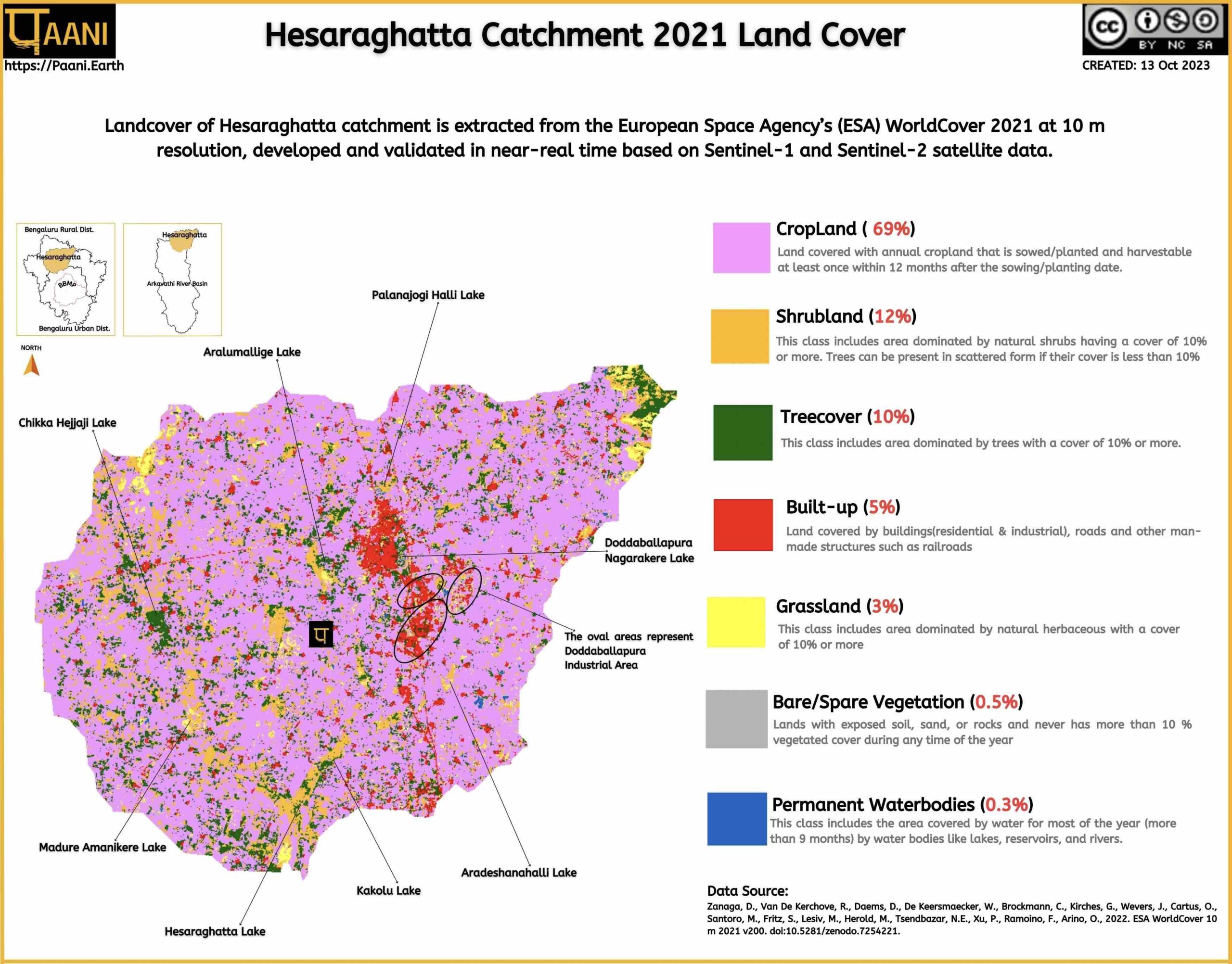
Hesarghatta Lake Catchment Landcover

Extracted from European Space Agency’s (ESA) WorldCover 2021
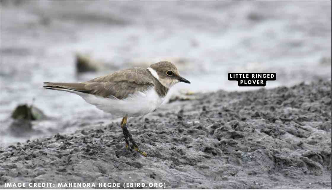
Birds spotted

Birds spotted and documented on e-bird

Lake Governance Related

Compilation of lake governance-related reports and articles

Creative Commons License
Paani.Earth by Paani.Earth is licensed under a Creative Commons Attribution-NonCommercial-ShareAlike 4.0 International License
Best Choice for Creatives
This Pop-up Is Included in the Theme
Purchase Now