
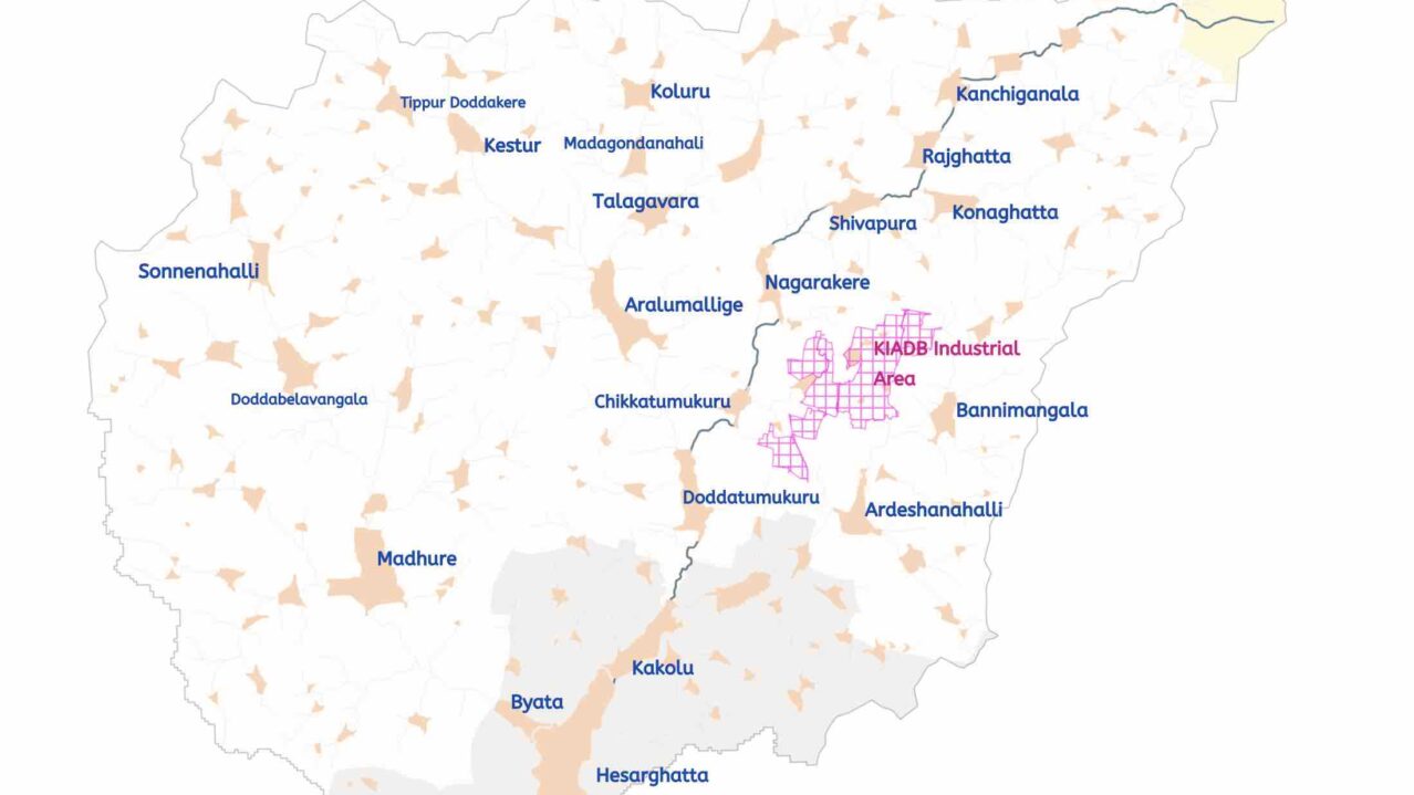
Hesaraghatta Catchment Map
Coming soon
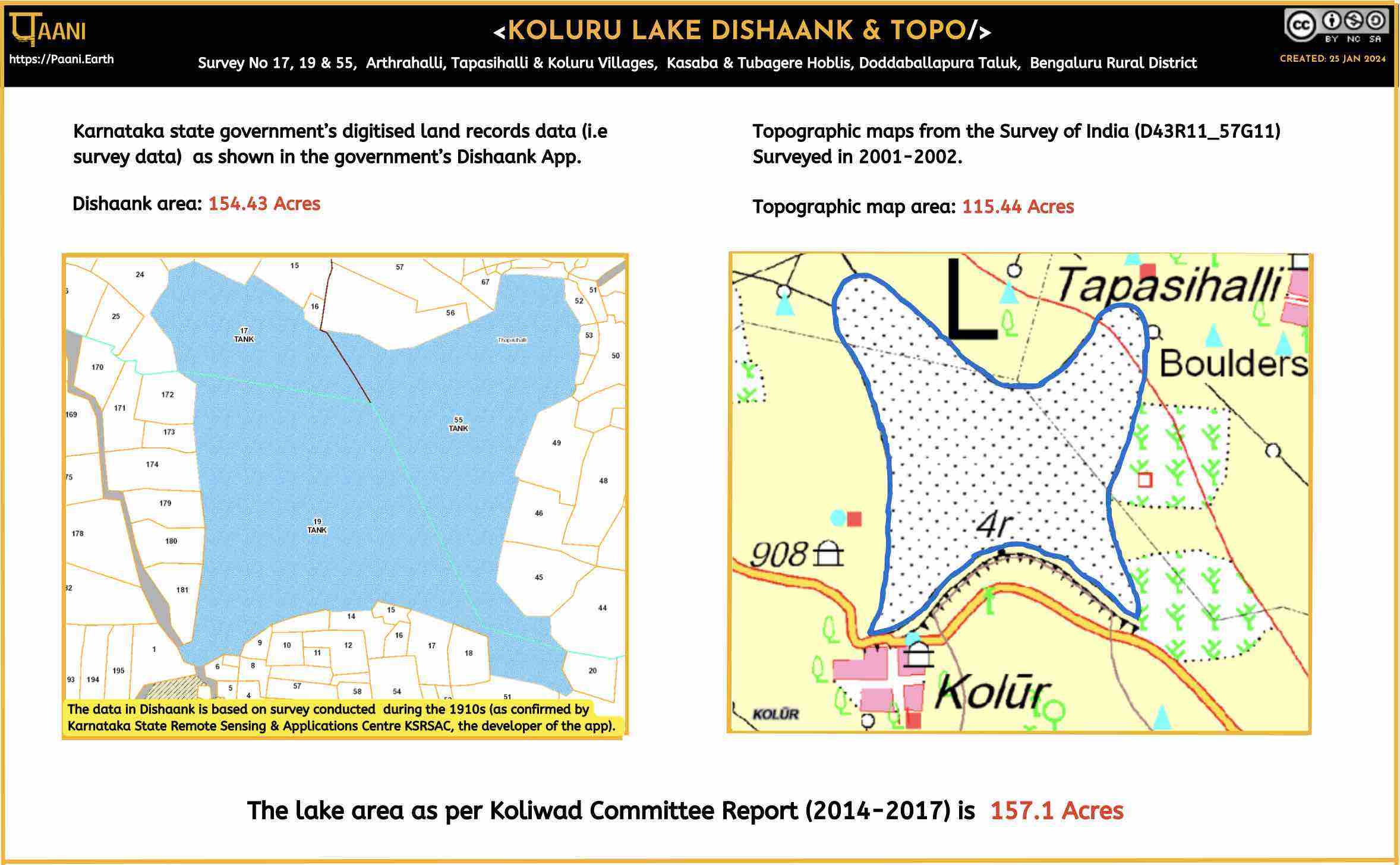
Dishank & Topo Maps
Koluru Lake as represented in Dishank and Topo Maps
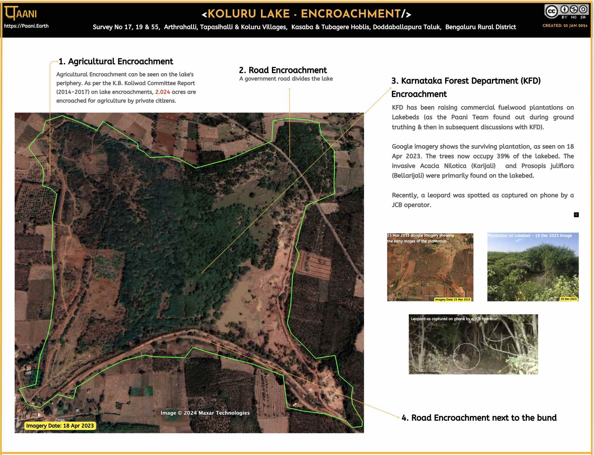
On Encroachment
Encroachment of Koluru lake including data from K.B Koliwad report

ESA 2021 Landcover
From European Space Agency’s (ESA) WorldCover 2021
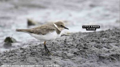
Birds Spotted
Birds data as documented on e-bird
Lake Governance Related
Compilation of lake governance-related reports and articles
