IN A NUTSHELL
Updated 07 Sept 2022
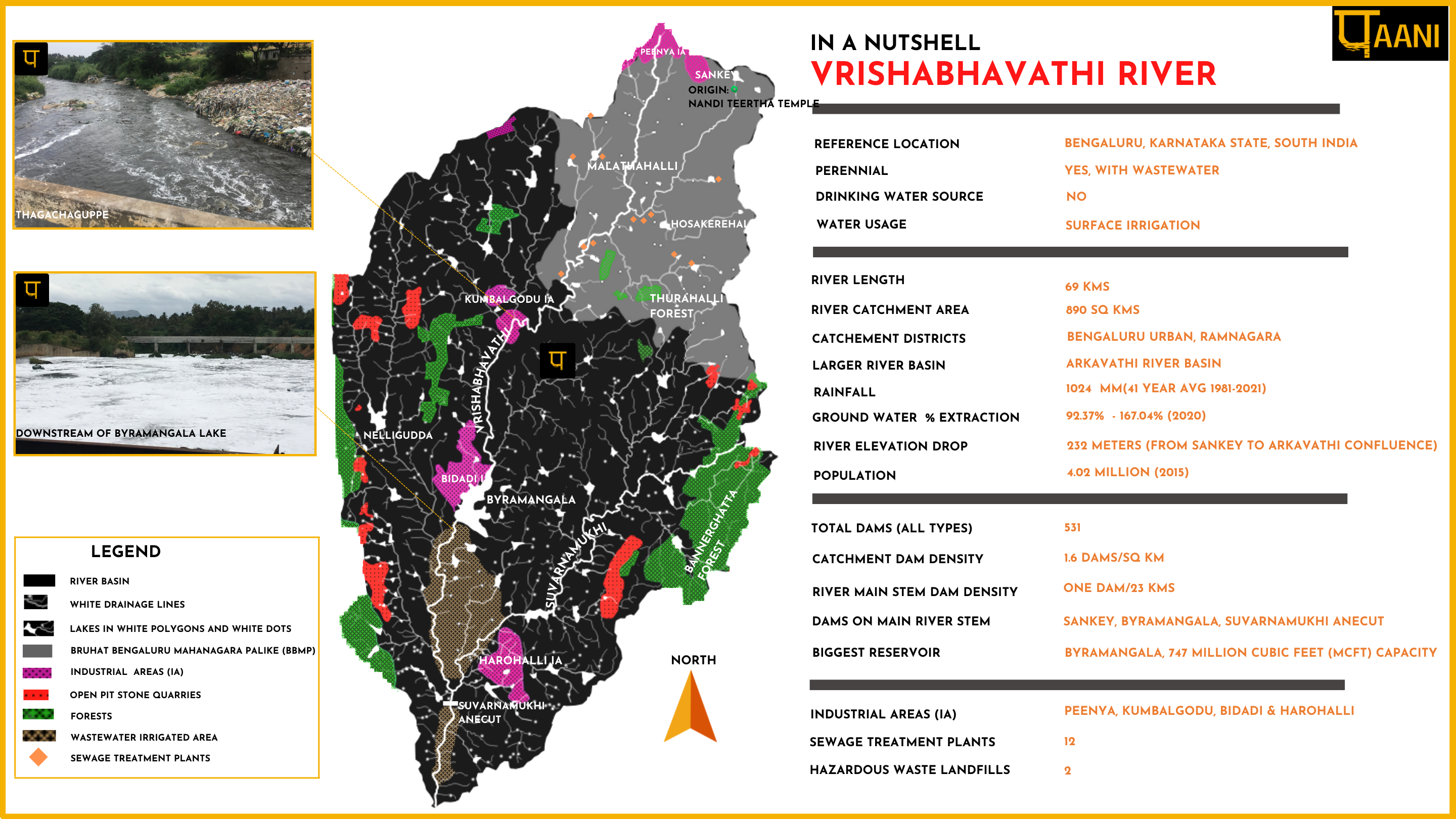
In a nutshell, is a brief summary representation of Vrishabhavathi river basin. It is a handy snapshot of the comprehensive Vrishabhavathi river basin map. The nutshell spatially represents drainage, lakes, tributaries, industrial areas, quarries, sewage treatment plants and protected areas along with a tabular representation of river basin data. Click Image to load the nutshell infographic.
![](https://paani.earth/wp-content/uploads/2022/04/FLOW.png)
RIVER BASIN
![](https://paani.earth/wp-content/uploads/2022/04/dams-img.png)
DAMS & FLOW
![](https://paani.earth/wp-content/uploads/2022/04/POLLUTION.png)
POLLUTION
![](https://paani.earth/wp-content/uploads/2022/04/GROUNDWATER.png)
GROUNDWATER
![](https://paani.earth/wp-content/uploads/2022/04/STRAWS.png)
STRAWS
![](https://paani.earth/wp-content/uploads/2022/04/BIODIVERSITY.png)
BIODIVERSITY
![](https://paani.earth/wp-content/uploads/2022/04/FLOODS.png)
RAINFALL FLOODS & DROUGHT
![](https://paani.earth/wp-content/uploads/2022/04/BASIN-FEATURES.png)
RESTORATION
![](https://paani.earth/wp-content/uploads/2022/04/MINING.png)