Skip to content Skip to footer

Hosakerehalli Lake is spread across 59 Acres, and 26 Guntas is located in the Vrishabhavathi river basin of Bengaluru city. This platform provides the necessary data points for citizens  & policymakers to address Hosakerehalli Lake and catchment concerns.

Rachna Ravikiran is Hosakerehalli lake activist.  She can be reached at ravikiran.rachna@gmail.com


Shows lake inlets, outlets and photos of Hosakerehalli Lake. Click the image on the left to load the profile.

The lake is in the Vrishabhavathi River Basin. 

The lake is in the Bengaluru Urban District. The Bengaluru Urban Hydrology Map shows the lake.

Hosakerehalli Lake Hydrology

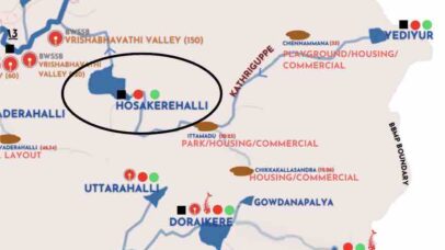
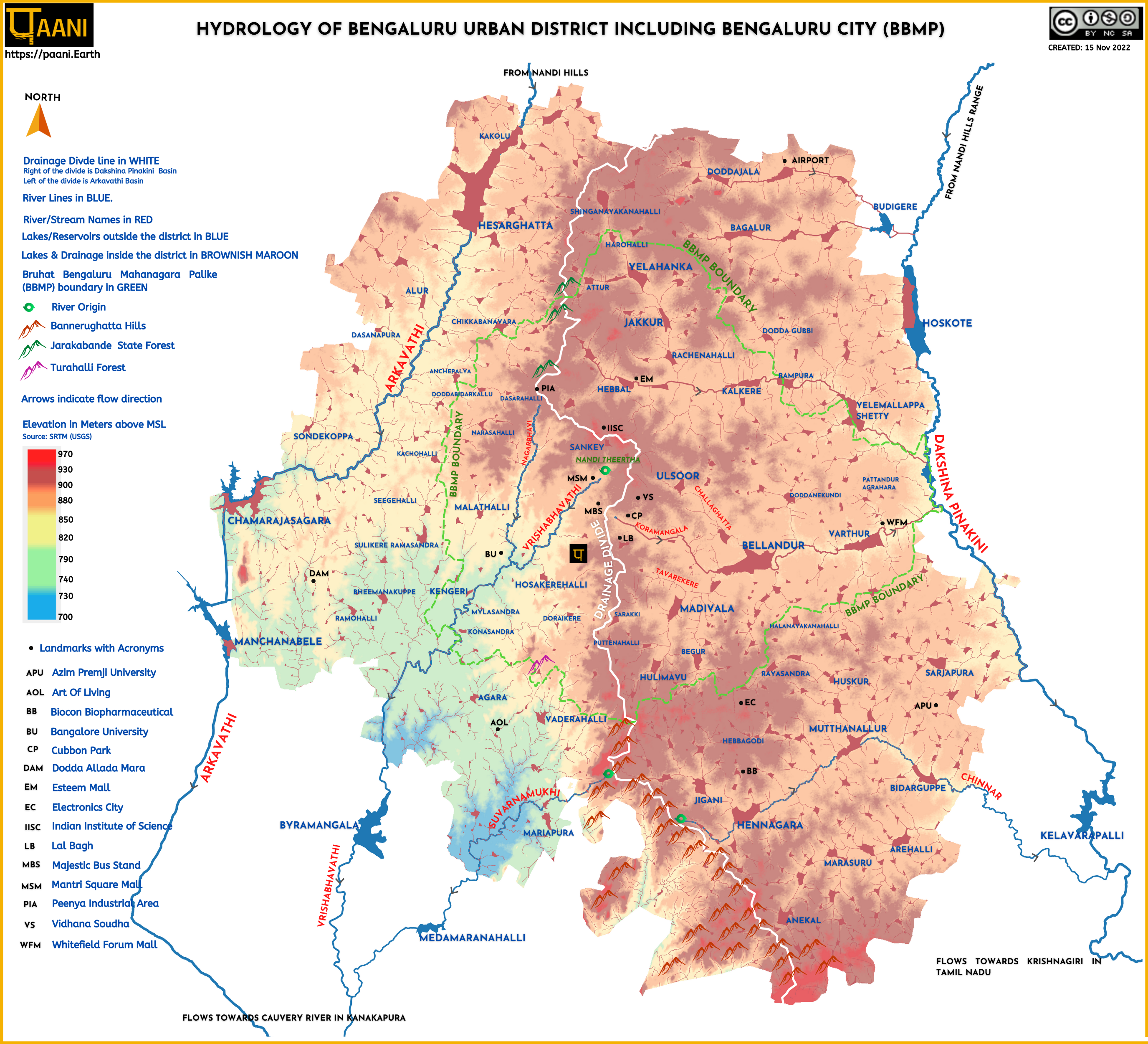
Hosakerehalli and its upstream lakes in the Vrishabhavathi River Basin map.
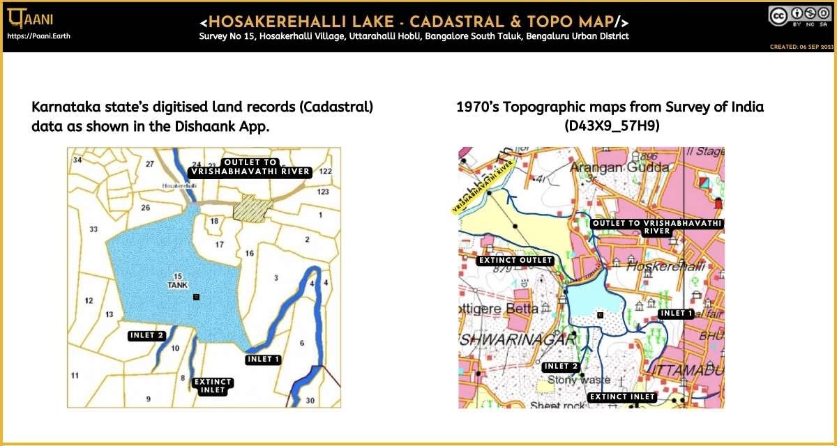
Dishank & Topo Maps

Hosakerehalli Lake as represented in Dishank and Topo Maps

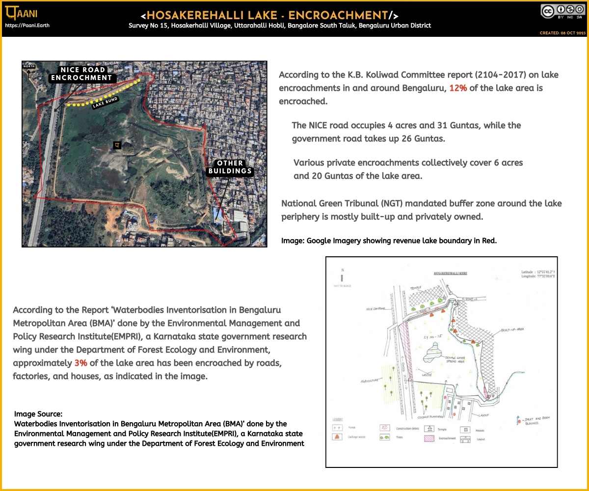
Lake Encroachment Data

Hosakerehalli Lake encroachment data from Koliwada and EMPRI lake atlas

2016 EMPRI Lake Profile

Includes Hosakerehalli Lake in Village Revenue Map .

Birds spotted

Birds spotted as documented on e-bird

Lake Governance Related

Compilation of lake governance-related reports and articles

Creative Commons License
Paani.Earth by Paani.Earth is licensed under a Creative Commons Attribution-NonCommercial-ShareAlike 4.0 International License
Best Choice for Creatives
This Pop-up Is Included in the Theme
Purchase Now