Updated 07 Sept 2022
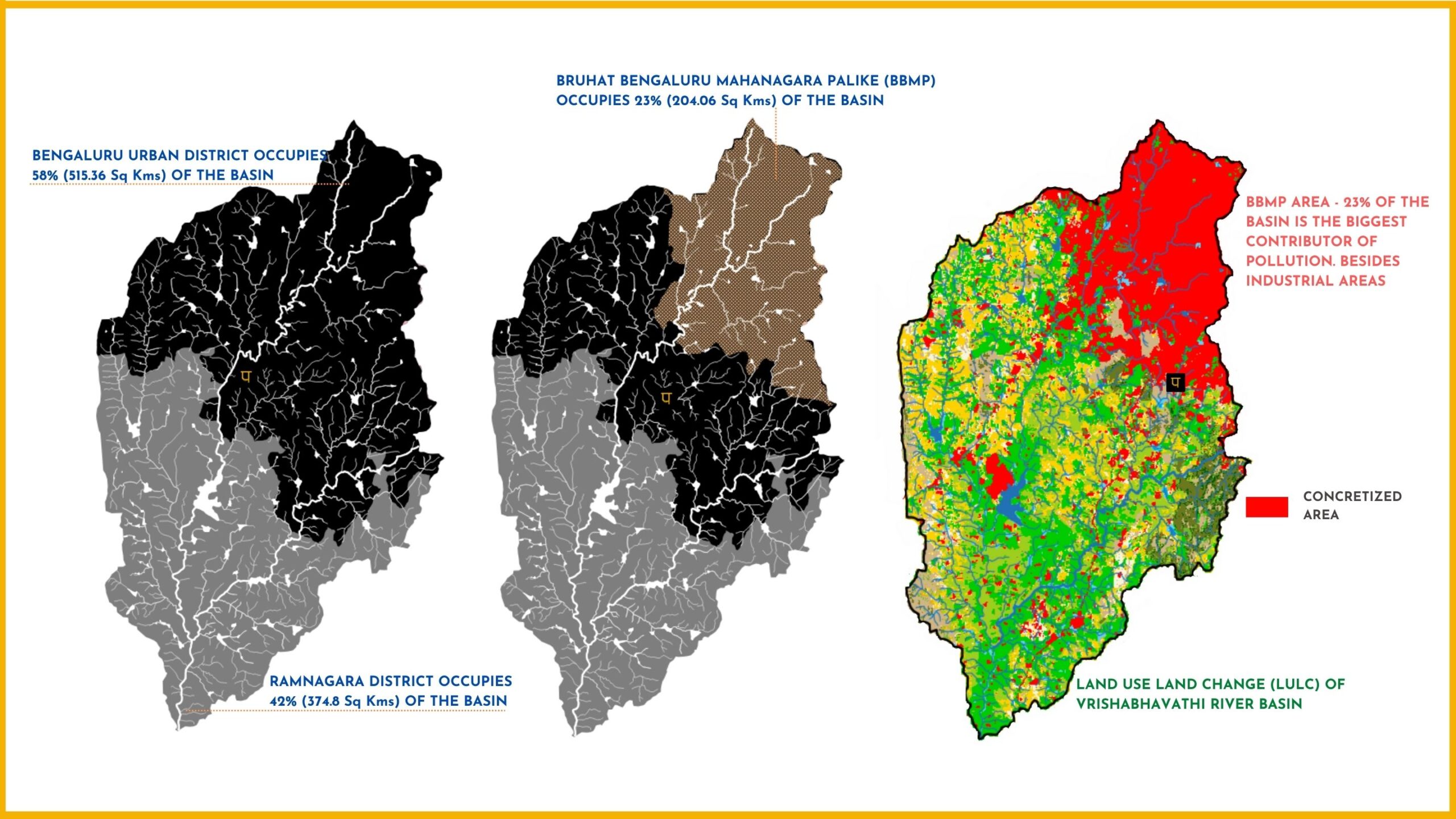
- Vrishabhavathi river basin is a spread over two districts – Bengaluru Urban (forms 58% of the basin) and Ramnagara (forms 42% of the basin) as shown in the image below.
- Bruhat Bengaluru Mahanagara Palike (BBMP)- Bengaluru Urban district’s city municipality, occupies 23% of the catchment.
- The 2015 Bhuvan’s land use land cover shows complete concretisation of the BBMP area. This concretized 23% is the single biggest contributor of sewage and solid waste in the river.

RIVER BASIN

DAMS & FLOW

POLLUTION

GROUNDWATER

STRAWS

BIODIVERSITY

RAINFALL FLOODS & DROUGHT

RESTORATION

