VRISHABHAVATHI RIVER BASIN RAINFALL
Updated 02 Sept 2022
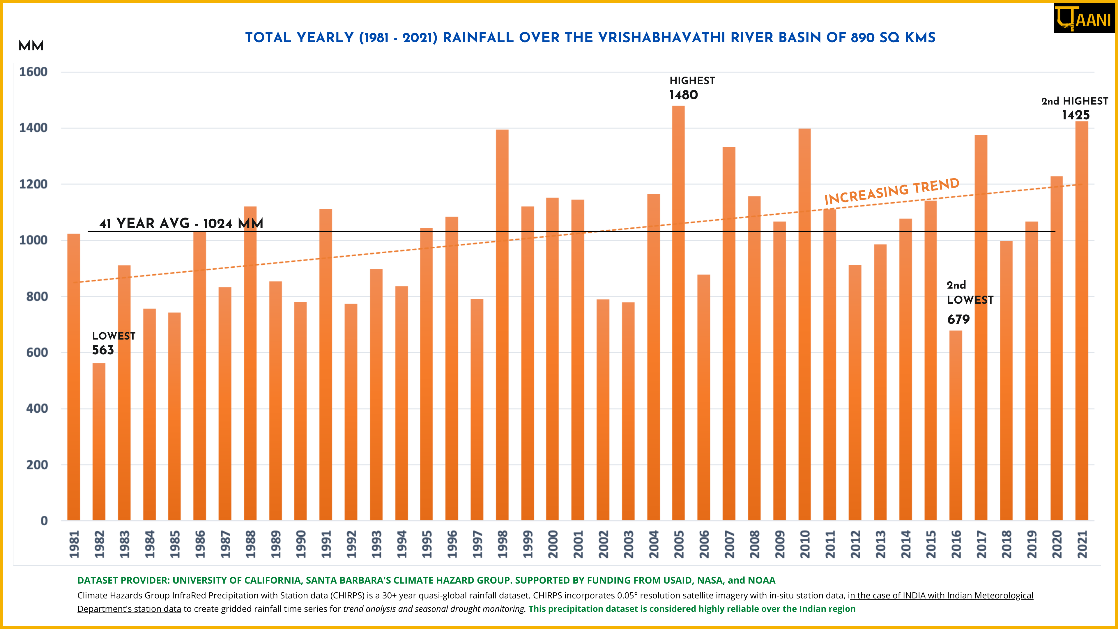
Yearly average rainfall from 1981 to 2021, sourced from CHIRPS , is plotted on the graph below.
- The rainfall shows an increasing trend with a 41-year average at 1024mm.
- The highest yearly rainfall of 1480mm was in year 2005 year, with the second highest being 1425mm in 2021.
- Total yearly rainfall exceeding 1400mm has occurred post year-2000.
- The lowest is recorded at 563mm in 1982.
![](https://paani.earth/wp-content/uploads/2022/04/FLOW.png)
RIVER BASIN
![](https://paani.earth/wp-content/uploads/2022/04/dams-img.png)
DAMS & FLOW
![](https://paani.earth/wp-content/uploads/2022/04/POLLUTION.png)
POLLUTION
![](https://paani.earth/wp-content/uploads/2022/04/GROUNDWATER.png)
GROUNDWATER
![](https://paani.earth/wp-content/uploads/2022/04/STRAWS.png)
STRAWS
![](https://paani.earth/wp-content/uploads/2022/04/BIODIVERSITY.png)
BIODIVERSITY
![](https://paani.earth/wp-content/uploads/2022/04/FLOODS.png)
RAINFALL FLOODS & DROUGHT
![](https://paani.earth/wp-content/uploads/2022/04/BASIN-FEATURES.png)
RESTORATION
![](https://paani.earth/wp-content/uploads/2022/04/MINING.png)